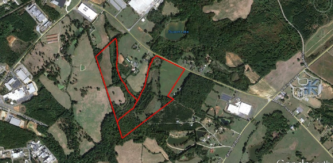
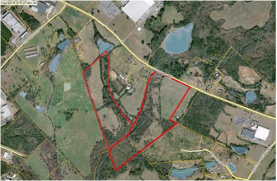
Property Record
Voyles Rd, Winterville, GA 30683
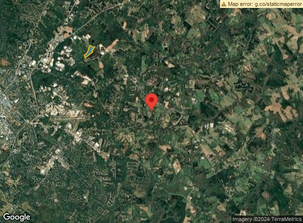

NEARBY LISTINGS FOR SALE OR LEASE
Property Detail
Voyles Rd
Athens-Clarke County, GA
Com-St-020->15-25
222-002-B
DEEDED ACS: 50.000
Privatepreserveopenspacevacantlandforestlandconservation
Clarke
AE
Georgia
13059C0017F
50 AC
2024
East Athens
2024
Other Market Areas
960204
DEMOGRAPHICS near Voyles Rd
1 Mile
3 Mile
5 Mile
2024 Total Population
187
16,415
72,436
2029 Population
186
16,605
73,519
Pop Growth 2024-2029
(0.53%)
+ 1.16%
+ 1.50%
Average Age
39
37
33
2024 Total Households
68
6,208
27,223
HH Growth 2024-2029
0.00%
+ 1.06%
+ 1.40%
Median Household Inc
$32,500
$49,413
$44,607
Avg Household Size
2.60
2.60
2.30
2024 Avg HH Vehicles
2.00
2.00
2.00
Median Home Value
$172,222
$142,319
$190,872
Median Year Built
1986
1990
1986
Nearby Places
- Restaurants
- Banks
- Shops
- Fitness
- Groceries
SALE & LEASE HISTORY
LISTING DATE
SALE/LEASE

Sep 24, 2016
For Sale
Nearby Properties
Address
Land Use
TOTAL SIZE
Lot Size
Zoning
Address
Land Use
TOTAL SIZE
Lot Size
Zoning
986 SF
40.54 AC
RM-1
Address
Land Use
TOTAL SIZE
Lot Size
Zoning
46.26 AC
G
Address
Land Use
TOTAL SIZE
Lot Size
Zoning
205,548 SF
22.68 AC
C-G(PD)
Address
Land Use
TOTAL SIZE
Lot Size
Zoning
9,588 SF
12.69 AC
RM-1
Address
Land Use
TOTAL SIZE
Lot Size
Zoning
12,032 SF
18.88 AC
RM-1
Address
Land Use
TOTAL SIZE
Lot Size
Zoning
31.44 AC
G
Address
Land Use
TOTAL SIZE
Lot Size
Zoning
39,167 SF
42.71 AC
RS-25
Address
Land Use
TOTAL SIZE
Lot Size
Zoning
8.70 AC
G
Address
Land Use
TOTAL SIZE
Lot Size
Zoning
43,619 SF
5.14 AC
C-G
Address
Land Use
TOTAL SIZE
Lot Size
Zoning
160,400 SF
8.58 AC
E-I
Address
Land Use
TOTAL SIZE
Lot Size
Zoning
2,800 SF
2.67 AC
C-G
Address
Land Use
TOTAL SIZE
Lot Size
Zoning
24,000 SF
6.65 AC
C-G(PD)
Address
Land Use
TOTAL SIZE
Lot Size
Zoning
25,624 SF
2.25 AC
R18H
Address
Land Use
TOTAL SIZE
Lot Size
Zoning
14,080 SF
18 AC
RS-8
Address
Land Use
TOTAL SIZE
Lot Size
Zoning
19,166 SF
5.18 AC
C-N
Address
Land Use
TOTAL SIZE
Lot Size
Zoning
2,177 SF
135.41 AC
P
Address
Land Use
TOTAL SIZE
Lot Size
Zoning
7.37 AC
C-G
Address
Land Use
TOTAL SIZE
Lot Size
Zoning
4,368 SF
8.50 AC
C1
Address
Land Use
TOTAL SIZE
Lot Size
Zoning
3,144 SF
1.99 AC
C-G(PD)
Address
Land Use
TOTAL SIZE
Lot Size
Zoning
13,389 SF
4.16 AC
C-N
Address
Land Use
TOTAL SIZE
Lot Size
Zoning
7,666 SF
2.72 AC
C-N
Address
Land Use
TOTAL SIZE
Lot Size
Zoning
10,900 SF
5.50 AC
C-N
Address
Land Use
TOTAL SIZE
Lot Size
Zoning
5,660 SF
1.69 AC
C-G
Address
Land Use
TOTAL SIZE
Lot Size
Zoning
78.75 AC
PG
Address
Land Use
TOTAL SIZE
Lot Size
Zoning
9,480 SF
1.73 AC
G
Address
Land Use
TOTAL SIZE
Lot Size
Zoning
6,479 SF
1.07 AC
C-N
Address
Land Use
TOTAL SIZE
Lot Size
Zoning
9,963 SF
2.38 AC
C-N
Address
Land Use
TOTAL SIZE
Lot Size
Zoning
2,574 SF
1.33 AC
C-G(PD)
Address
Land Use
TOTAL SIZE
Lot Size
Zoning
1.81 AC
G
Address
Land Use
TOTAL SIZE
Lot Size
Zoning
43.36 AC
E-I
The World's #1 Commercial Real Estate Marketplace
Connect with us
© 2025 CoStar Group
The information above has been obtained from sources believed reliable. While we do not doubt its accuracy we have not verified it and make no guarantee, warranty or representation about it. It is your responsibility to independently confirm its accuracy and completeness. Any projections, opinions, assumptions, or estimates used are for example only and do not represent the current or future performance of the property. The value of this transaction to you depends on tax and other factors which should be evaluated by your tax, financial, and legal advisors. You and your advisors should conduct a careful, independent investigation of the property to determine to your satisfaction the suitability of the property for your needs.